Pastāsti draugiem par šo preci:
Rand McNally Folded Map: Tampa-St. Petersburg-Ocala to Sarasota Regional Map
Do you have a profile? Pierakstīties
 Ziemassvētku dāvanas var atgriezt līdz 31. janvārim

Saņemiet paziņojumus par jauniem Rand McNally izdevumiem
Mūsu klienti saka:


Pievienot savam iMusic vēlmju sarakstam
Rand McNally Folded Map: Tampa-St. Petersburg-Ocala to Sarasota Regional Map
Rand McNally
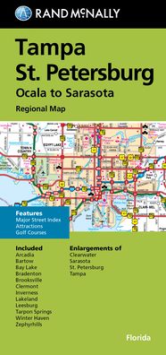
Rand McNally's folded map for Tampa St. Petersburg is a must-have for anyone traveling in and around this part of Florida, offering unbeatable accuracy and reliability at a great price. Our trusted cartography shows all Interstate, U. S., state, and county highways, along with clearly indicated parks, points of interest, airports, county boundaries, and streets. The easy-to-use legend and detailed index make for quick and easy location of destinations. You'll see why Rand McNally folded maps have been the trusted standard for years. -Regularly updated. -Full-color maps. -Clearly labeled Interstate, U. S., state, and county highways. -Indications of parks, points of interest, airports, county boundaries, downtown & vicinity maps. -Major attractions & Golf Courses. -Enlargements of Clearwater, Sarasota, St. Petersburg & Tampa. -Easy-to-use legend. -Detailed index & Major Street Index. -Convenient folded size. Coverage Area: Communities included, Arcadia, Bartow, Bay Lake, Bradenton, Brooksville, Clermont, Inverness, Lakeland, Leesburg, Tarpon Springs, Winter Haven, Zephyrhills. Product Details: Measures 9.5' x 4' and folds out to 40' x 28'.
| Mediji | Grāmatas Map (Zemes vai jūras kartes) |
| Izlaists | 2021. gada 22. septembris |
| ISBN13 | 9780528025488 |
| Izdevēji | Rand McNally |
| Izmēri | 106 × 226 × 12 mm · 60 g |
| Valoda | Angļu |