Pastāsti draugiem par šo preci:
Kefalonia & Ithaca Complete Topographic Map Atlas 1 Sergio Mazitto
Pasūtīts no attālās noliktavas
Mūsu klienti saka:


Kefalonia & Ithaca Complete Topographic Map Atlas 1
Sergio Mazitto
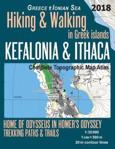
Updated 2018 edition. Large scale, highly detailed topographic map 1:30.000 for hiking and trekking, printed as an atlas book (with overlapping pages). Most geographic names are given in both English and Greek.
Complete map of the islands of Kefalonia (also spelled as Cefalonia, Cephalonia) and Ithaca (Ithaka, Ithaki). The maps show great walks and wonderful hiking trails in the area. Kefalonia, formerly also known as Kefallinia or Kephallenia, is the largest of the Ionian Islands in western Greece.
Ithaka is generally identified today with Homer's Ithaca, the home of Odysseus in the epic poem The Odyssey. The island has been known by many names throughout times: Val di Compare, Piccola (Small) Cephallonia, Anticephallonia (Middle Ages till the beginning of the Venetian period), Ithaki nisos (Greek for island), Thrakoniso, Thakou, Thiakou (Byzantine period), Thiaki (Byzantine and before the Venetian period), Teaki (Venetian period), Fiaki (Ottoman period).
20 meter contour lines, road network, trails & paths, transportation, food, campsites, shelters, guest houses & hotels. Mercator projection with both UTM and WGS84 coordinate grids.
The map scale of 1:30000 (1 cm = 300 meters) provides a wealth of detail while keeping low the weight of the atlas itself. The large page format of 8.5x11in minimizes page count and along with an overlapping map design allows for comfortable navigation.
The details included in the topographic maps of this atlas were specifically selected to be useful for trekkers, hikers and walkers of all interests, and make it easy to plan and enjoy both short excursions and hikes as well as long multi-day adventures along the main marked routes and/or adjacent trails and paths, which are also shown on the maps.
With this ultralight atlas you will always have a detailed, reliable, information-rich, battery-independent, shatter-proof map for your adventure.
| Mediji | Grāmatas Paperback Book (Grāmata ar mīksto vāku un līmēto muguru) |
| Izlaists | 2018. gada 4. maijs |
| ISBN13 | 9781718660250 |
| Izdevēji | Createspace Independent Publishing Platf |
| Lapas | 44 |
| Izmēri | 216 × 279 × 3 mm · 167 g |
| Valoda | Angļu |